


Voting District 20170, Kern County, California
About
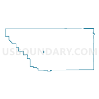
Outline

Summary
| Unique Area Identifier | 531754 |
| Name | Voting District 20170 |
| County | Kern County |
| State | California |
| Area (square miles) | 3.02 |
| Land Area (square miles) | 3.02 |
| Water Area (square miles) | 0.00 |
| % of Land Area | 100.00 |
| % of Water Area | 0.00 |
| Latitude of the Internal Point | 35.24525030 |
| Longtitude of the Internal Point | -119.08328880 |
Maps


Graphs
Select a template below for downloading or customizing gragh for Voting District 20170, Kern County, California


Neighbors
Neighoring Voting District (by Name) Neighboring Voting District on the Map
- Voting District 20165, Kern County, CA
- Voting District 20180, Kern County, CA
- Voting District 20185, Kern County, CA
- Voting District 20190, Kern County, CA
- Voting District 40635, Kern County, CA
- Voting District 40640, Kern County, CA
- Voting District 40800, Kern County, CA
Top 10 Neighboring County Subdivision (by Population) Neighboring County Subdivision on the Map
Top 10 Neighboring Place (by Population) Neighboring Place on the Map
Top 10 Neighboring Elementary School District (by Population) Neighboring Elementary School District on the Map
- Panama-Buena Vista Union Elementary School District, CA (119,146)
- Lakeside Union Elementary School District, CA (8,833)